Livable Tarrytowns lost a great friend earlier this month when Anne White passed away.
Anne was a longtime advocate of “complete streets”–at least from the time she moved to St. Paul, Minnesota (in 2003). A former professional photographer and, beginning at the age of 80, a writer of poetry, Anne relocated to Sleepy Hollow in 2016. Over the last few years, Anne was a constant, enthusiastic, and tireless presence at Livable Tarrytowns gatherings. The building of bridges between advocates/activists and village officials was a chief concern of Anne’s.
Anne’s commitment to environmental sustainability and safe streets for all will continue to inspire the work of Livable Tarrytowns. In this way, and in many others, she lives on.
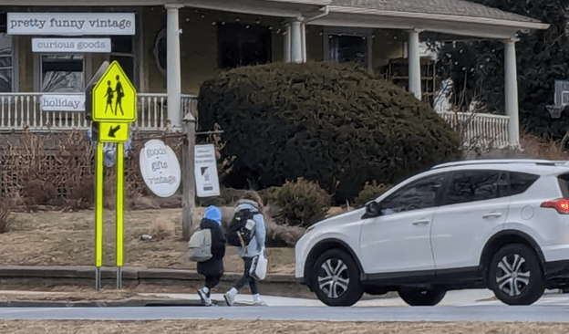
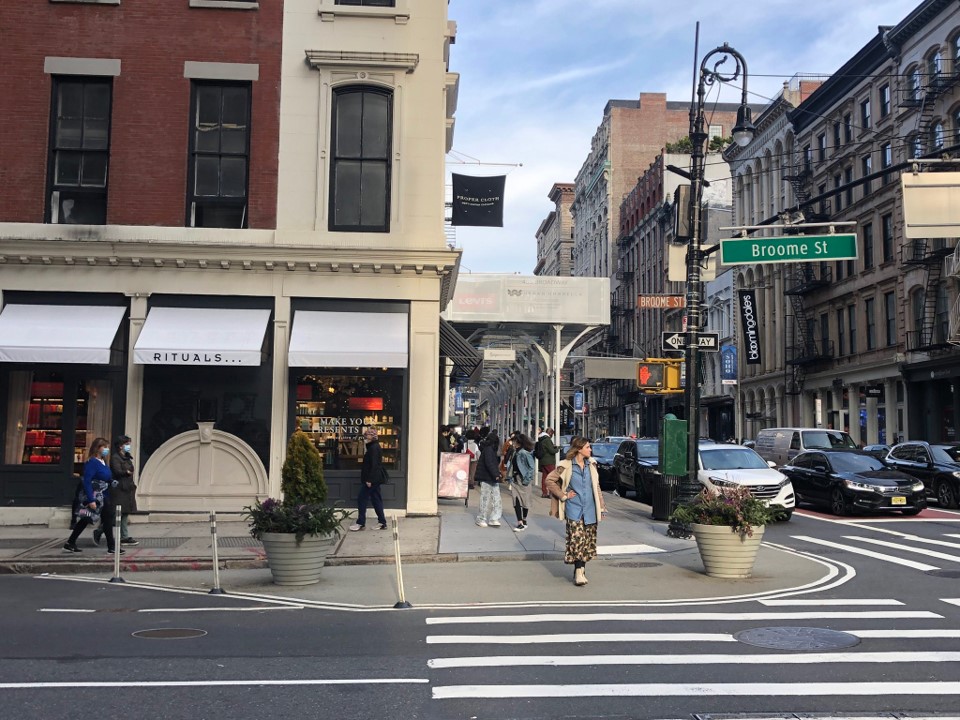
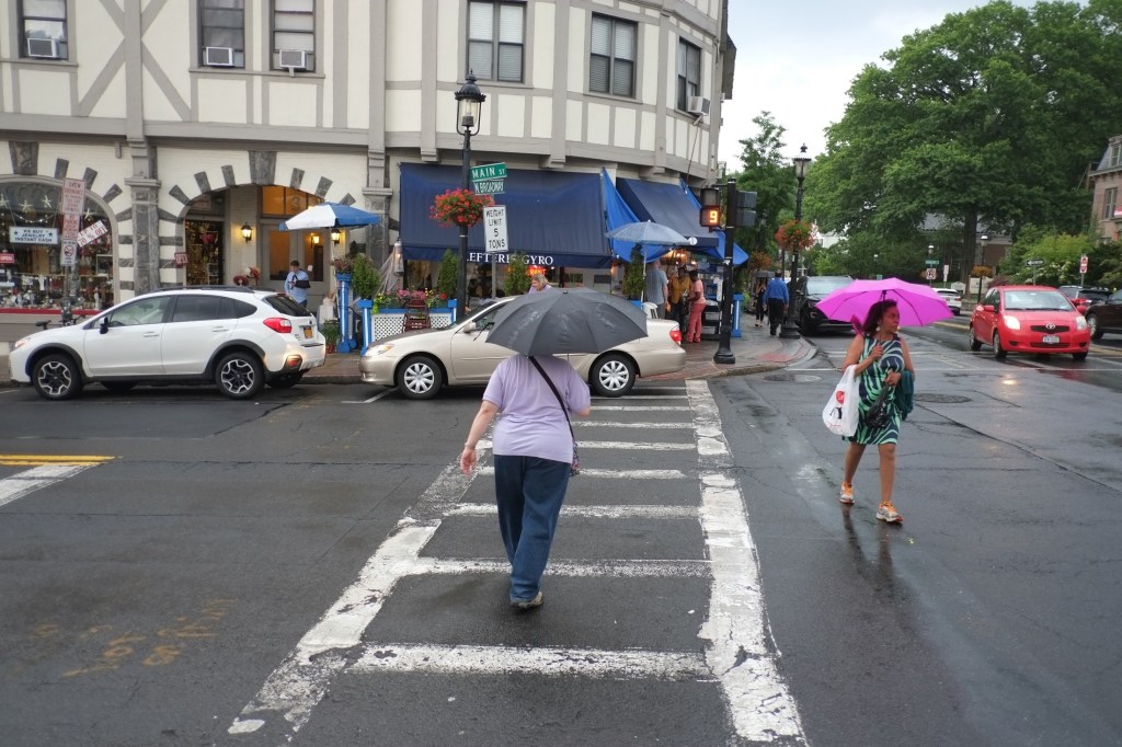
Washington Irving students crossing Broadway at Franklin, January 13, 2025. Photo by Giselle Schuetz.
Livable Tarrytowns has a long list of wishes for 2025. Near the top of that list are far-reaching changes to the Broadway and Franklin Street intersection.
Because it is adjacent to the Washington Irving School, the intersection sees a lot of pedestrian traffic. And because it is poorly designed, the intersection poses a threat to people crossing both Broadway and Franklin Street.
As many parents have informed us, and numerous Livable Tarrytown members themselves have experienced, “near-misses”—when motor vehicles come close to striking a pedestrian—are common. Madeline Praino, a retired, longtime TUFSD teacher, for example, told us about crossing Franklin Street at around 4 pm one fall afternoon in 2023. A vehicle traveling northward on Broadway took a left at Franklin while focusing only on the oncoming traffic on Broadway, not paying any heed to Franklin Street itself. The vehicle almost struck Ms. Praino and her granddaughter. The same thing happened to the pair a second time this past December.
And then there are the “non-misses.”
In 2020, a motor vehicle struck a 4th-grader in the crosswalk, breaking his arm.
Prior to that, between 1987 and 2019, according to the New York State Department of Transportation, the intersection saw 96 vehicle crashes, resulting in 78 “minor” injuries and 4 “serious” ones. Ten of the crashes resulted in minor injuries to people walking.
Despite so many crashes and injuries, there has been no redesign of the intersection, and no implementation of infrastructural changes that compel drivers to proceed with caution.
A recent incident illustrates one reason why crossing Broadway at Franklin can be so dangerous.
On the afternoon of October 2, 2024, children were partaking in after-school play at the Washington Irving campus. During this time, two 9-year-old participants announced that they were going to walk home. Because they had no adults with them and the crossing guard was no longer on duty, a parent who was present, Denis Fogarty, told them that he would help them traverse Broadway.
In an email with DOT officials, Mr. Fogarty explains what happened next as they waited on the sidewalk to cross from the west side to the east side of the thoroughfare. “We made eye contact with the driver heading southbound and the minibus driver headed northbound and both vehicles stopped. As we walked across the street, I was forced to grab the children and pull them back. A sedan, which was behind the minibus, could not see why the bus had stopped darted into the crosswalk. This is possible as Franklin St runs perpendicular east, into Broadway and gives cars the space to make such a maneuver.” (See the illustration below.)
The blue and yellow blocks represent the vehicles that stopped for Mr. Fogarty and the two children. The red block and arrows represent the car that went around the minibus (in yellow) and almost struck them. Illustration by Denis Fogarty.
In response to Mr. Fogarty’s email, Jenny Baez, the NYSDOT Area Construction Supervisor, said that the agency “has no current construction projects scheduled” to reconfigure the intersection. She went on to report that “[a]ny future work by the NYSDOT at the intersection of U.S. Route 9 and Franklin Street would be done as part of the U.S. Route 9 Complete Streets project if determined to be feasible.”
Such work, optimistically speaking, is years down the proverbial road. While the intersection is in the Village of Tarrytown, Broadway is a state thoroughfare and thus any changes to the roadway require approval from the NYSDOT. For the Village to remake the intersection requires permission from New York State authorities.
In recognition of both the dangerous nature of the intersection and the DOT’s responsibility for its design and maintenance, Tarrytown’s Board of Trustees unanimously passed a resolution on November 4. It requests “that the New Yok State Department of Transportation investigate a short-term solution to improve pedestrian safety at the intersection of Franklin Street and Rt. 9/Broadway and provide resources to make this important safety improvement.” Three days after the decree’s passage, the Village sent the resolution, along with a letter, to the DOT.
As of this writing, the DOT has not responded to the Village of Tarrytown.
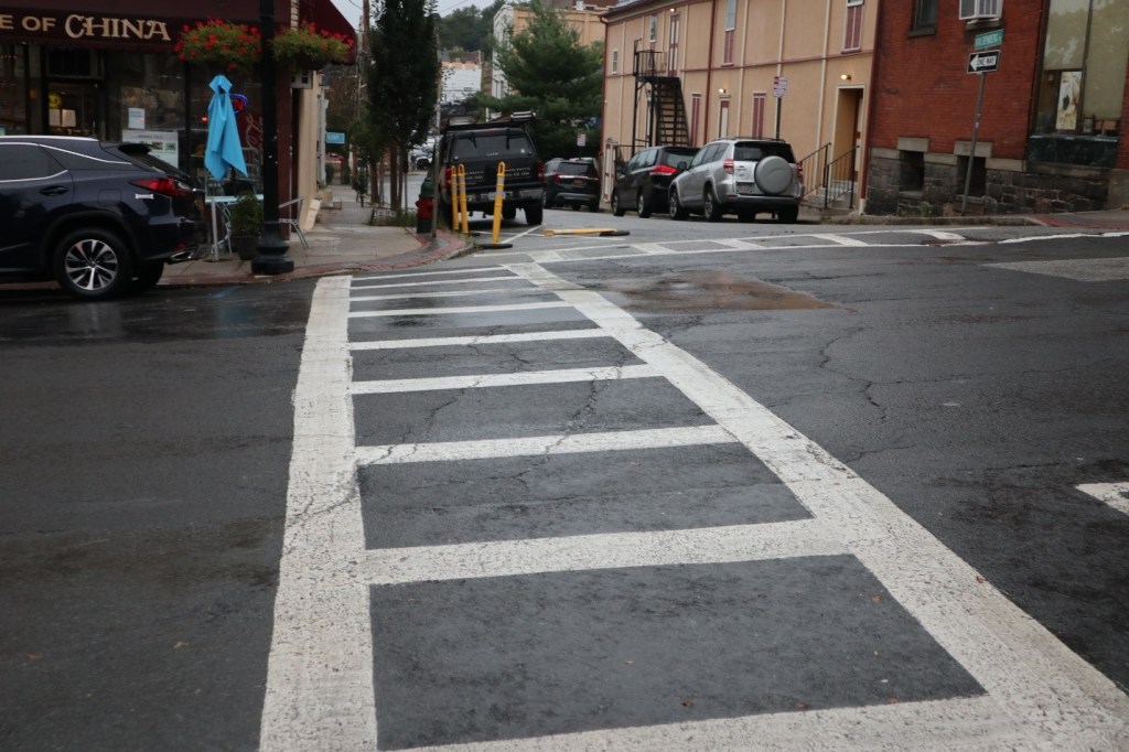
Still, there are important measures that the Village can implement. Indeed, last week, the Tarrytown Police Department installed mid-road signage similar to what the Village has put into place at Broadway and McKeel. (See image below.)
Broadway at Franklin, looking southward, January 13, 2025. Note the mid-road signage. Photo by David Kim.
What could also prove quite helpful in the immediate term is if the Village were to set out traffic cones on school days to restrict northbound Broadway traffic flow to one lane and thus prevent cars from driving around vehicles properly stopped at the crosswalk. This would entail, relatedly, parking a police vehicle near the middle of Broadway to warn drivers to slow down in the approach to the crosswalk. (See illustration below.)
The blue rectangle represents a parked police vehicle. The red dots represent traffic cones.
Following the implementation of these measures, the Village could commission a redesign of the intersection and then, via the NYTDOT’s highway work permit process, implement that redesign.
Beyond the intersection, Franklin Street itself needs significant work to enhance safety for drivers, passengers, and pedestrians alike. This past October, a collision between a school bus and a car occurred on the street.
Pedestrians, especially those walking on the south side of Franklin, do not feel secure because of the speed at which many vehicles travel and the narrowness of the sidewalk. In addition, regarding the stretch west of the Washington Irving parking lot, the presence of utility poles can make it difficult for people with strollers to use it. Widening the sidewalk is something the Village should explore.
From October 15 through December 15, 2023, Livable Tarrytowns and Bike Tarrytown conducted a pedestrian safety survey. Advertised by way of flyers posted around Sleepy Hollow and Tarrytown, email, and various social media channels, the survey attracted close to 600 responses.
Respondents, many of whom wrote about more than one particular site, raised a total of 785 concerns about unsafe walking locations in the two villages. Not surprisingly, many wrote about the same crossing point, intersection, or street. Still, as shown on the map we generated, survey respondents highlighted over 100 problem areas. In this way, they made clear that problems with pedestrian safety in Sleepy Hollow-Tarrytown are not limited to a small number of intersections or thoroughfares, but are widespread.
“My friends and I came to Tarrytown as tourists for the first time, and the first thing we noticed was how cars don’t yield to pedestrians.”
Pedestrian Safety Survey participant
Numerous people expressed fear about traversing the two villages. As one individual wrote in regard to Central Avenue and Broadway in Tarrytown, “Crossing the street with little kids is terrifying and I see it on the faces of other parents too. Like they don’t really know if they’ll be seen and then have to sprint.” Not surprisingly, the Broadway/Route 9 corridor received the highest number of responses by far. And, as shown in the map generated from the results, a small number of areas along that corridor received the lion’s share of attention. (Many thanks to Neil Curri, a cartographer and GIS Lab Manager at Vassar College, for donating his time and skilled labor and producing the map.)
“Crossing the street with little kids is terrifying and I see it on the faces of other parents too. Like they don’t really know if they’ll be seen and then have to sprint.”
Survey respondent re: Central Avenue and Broadway in Tarrytown
There are two areas of greatest concern along Broadway.
Partial view from Broadway of the intersection. Bedford Road is to the right, New Broadway in straight ahead, and Route 9, heading northward bends to the left. Source: Screen shot of video produced by Bike Tarrytown.
The first is the five-way intersection (of sorts) where Bedford Road, Beekman Avenue, Hudson Terrace, and New Broadway all converge with Broadway/Route 9 in Sleepy Hollow, a highly dangerous area of longstanding concern among local residents. Respondents suggested various traffic-calming “fixes” to this highly dangerous area, ones ranging from raised crosswalks to pedestrian-activated strobe lights. Over the years, Bike Tarrytown has also made many recommendations, including curb extensions, for the area.
The second is where McKeel Avenue and Broadway converge. As reported in our previous blog post, Bike Tarrytown and Livable Tarrytowns have come up with concrete proposals–short-term and long-term–to transform the intersection, one that has proven deadly for pedestrians on two occasions since August 2022.
While there are many other areas in need of attention, we briefly mention four more that survey respondents highlighted.
Neperan Avenue and the Old Croton Aqueduct Trail (Tarrytown): Vehicles parked immediately adjacent to where the trail crosses Neperan on the north side of the street block the line of sight. There are also no markings indicating that where the OCA and Neperan intersect is a crossing location for pedestrians and cyclists. A curb extension or “pinchpoint” on the north side of Neperan, a raised crosswalk and signage–among other changes–are desperately needed.
Bedford Road, Webber Avenue, and the Old Croton Aqueduct (Sleepy Hollow): This is a key school route for students and their families. It is also where the aqueduct trail enters the TUFSD campus. Due to the lack of a crosswalk, the speed of cars coming down the hill, and the low visibility due to curves, this is a hazardous crossing location for pedestrians.
Depot Plaza and West Main Street at Railroad Avenue (Tarrytown): Due to many people walking to and from the train station, this is a heavily pedestrianized area. Of high concern are the two crosswalks that connect the Metro North station and Tarrytown Village Hall. Drivers frequently speed and ignore pedestrians within the crosswalks or block the crosswalks (particularly on the station side of the street) with their vehicles. Some simple engineering–curb extensions and raised crosswalks, for example–could greatly enhance pedestrian safety in the area. Also unsafe is the west (river) side of the station, at the bottom of the H-bridge, where West Main and Railroad Avenue meet. An area of frequent speeding, there is a need for wider sidewalks, additional crosswalks, and traffic calming interventions in the general area.
Franklin Street and Broadway (Tarrytown): Students and their families walking to and from the Washington Irving Intermediate School have to cross two busy streets that are heavily trafficked. According to reports received by Livable Tarrytowns, there have been a lot of “close calls” at this intersection and it is in need of urgent attention and remediation.
“[The villages] are not safe for anyone: sidewalks are terrible, a hazard, especially to [those who are] impaired, disabled, kids, and seniors.”
“It’s truly shameful how poor pedestrian infrastructure is on the main route for train commuters.”
Respondents to the Pedestrian Safety Survey
How to view the map
The map is a compilation of all the responses to the survey that we received. If you click on the image below, it will bring you to the interactive map.
It is a “heat map.” A heat map shows the relative number of responses received by locations. In this case, yellow indicates the highest number of responses in an area, followed by red, and then purple (light purple being a relatively low number).
Viewers can control the size of the map via the “zoom” features (the “+” and “-” signs in the upper right corner.
A yellow dot indicates a location that at least one survey respondent raised concerns about. If you click on one of them, a box such as that to the right will emerge. In the bottom right corner, it indicates how many respondents wrote about the location (four in the case of Beekman and Pocantico). Viewers can scroll through the various responses using the arrows in the bottom left corner, and thus how survey takers described the problem, their suggestions for improvements, and any other comments.
This is a local road with 30 mph speed limits, not a highway. Why is it designed like a highway?
Survey respondent re: White Plains Road in Tarrytown
Next steps
On Saturday, February 24, 2024, Livable Tarrytowns had a meeting at the Warner Library to present and discuss the results of the survey. Twenty-five residents of Sleepy Hollow and Tarrytown were in attendance.
In the second half of the gathering, attendees organized themselves into three groups to focus on specific problem areas. Group members brainstormed about the changes they would like to see and how to bring them about–by working with local and state officials as well as with residents and non-governmental entities in the area. These groups are now standing bodies under the umbrella of Livable Tarrytowns, each of which has a particular focus.
The three groups are:
The School Safety Zone Working Group: Its focus is the slowing down of traffic in the vicinity of all schools in the Tarrytowns and the development of safe walking and cycling routes to and from those schools–both of which require changes in the streetscape and the associated infrastructure.
The Broadway for All Working Group: While the entire Broadway corridor in Sleepy Hollow and Tarrytown is the group’s concern, its initial focus is on Broadway and McKeel. Its broader goal is to transform Broadway so that it a safe and enjoyable thoroughfare for pedestrians and bicyclists alike.
The Old Croton Aqueduct Working Group: This group concentrates on where the aqueduct trail intersects streets to ensure that crossing locations are safe for pedestrians. Its initial focus is on where the trail crosses Neperan Road in Tarrytown and Bedford Road in Sleepy Hollow.
If you would like to join a working group (or start one of your own), please send an email to livabletarrytowns@gmail.com.
In the coming weeks and months, Livable Tarrytowns will share the survey findings with officials in the two villages and the public school district. The survey is one tool among many that we need to deploy to win support for far-reaching changes needed to make the villages’ thoroughfares–and public space more broadly–safe and welcoming to all, particularly for the most vulnerable among those who live and work here.
Postscript:River Journal ran an article about the survey and the findings. You can find the article here.
A recent four-week span has tragically exposed, yet again, how dangerous Broadway is for pedestrians in Sleepy Hollow-Tarrytown. It also painfully highlights the urgency of transforming the principal thoroughfare that joins the twin villages for the well-being of our families, friends, and neighbors.
Less than one month later, on Tuesday, December 26, at a little before 2 p.m., a driver hit and killed Patrick Kennedy, 79, also of Tarrytown, while he crossed Broadway at Route 119.
In both instances, the victims were in marked crosswalks when they were struck.
The untimely deaths have renewed and intensified efforts to make Broadway safe for all—pedestrians, bicyclists and drivers.
Concerned residents, many of them involved with Livable Tarrytowns and Bike Tarrytown, met twice in December. They brainstormed and discussed changes that they would like to see to the design of what Anne White, co-head of Sustainable Sleepy Hollow and a meeting participant, has referred to as the “Main Street” of the two villages. The initial focus has been on the area of Broadway and McKeel given that it has been the site of two vehicle-induced fatalities of pedestrians since August 2022. (On August 4, 2022, a driver and his pickup truck killed Mr. Anthony Napoli, 70, on McKeel, between the Croton Aqueduct and Broadway.)
Out of work already done in relation to the Route 9 Active Transportation Project, ideas generated by the discussions, and the design efforts of Bike Tarrytown, two proposals have emerged for what a “good” Broadway and McKeel would look like.
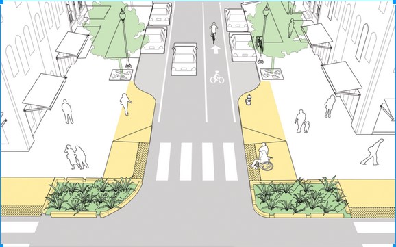
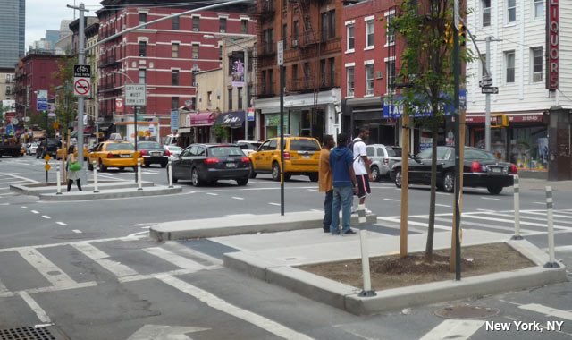
The first proposal (above) is for a pilot project to address safety issues in the short term. It would entail the creation of medians (indicated in purple) in the middle of Broadway via temporary barriers so that pedestrians have a refuge and that they don’t have to cross multiple lanes of traffic. It would also include curb extensions that lessen the distance that pedestrians must traverse in crossing a street. These modifications would have the added benefit of “daylighting” the crosswalks (with two crosswalks added at Dixon Street), thus enhancing pedestrian visibility and welfare.
Pedestrian refuge, New York City.
McKeel Avenue itself would also see changes in the form of a median refuge and a narrowing of the road in proximity to Broadway. The redesign would increase the likelihood that drivers travel at safe speeds. Had these alterations been implemented prior to August 2022, they might very well have saved Mr. Napoli’s life.
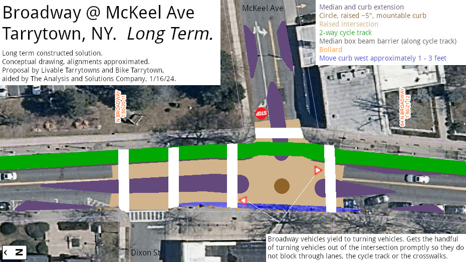
The second proposal is for a “permanent” or long-term transformation. As illustrated by the drawing below, the changes would include raising the intersection—from Dixon Street to McKeel Avenue—along Broadway and elevating the crosswalk that traverses McKeel as well. It would also involve installing a two-way, protected bicycle track along the east side of Broadway.
Proposal for long-term changes at Broadway and McKeel Avenue, January 2024.
In regard to the proposed changes on McKeel Avenue, the Village of Tarrytown has full authority to make them as it controls the road. Making changes on Broadway, however, is a different matter as the New York State Department of Transportation (NYSDOT) is in charge of the thoroughfare.
If past practice is any indication, it is doubtful that New York’s DOT will be keen on changes to Broadway anywhere near as ambitious as the ones proposed above. The state agency has long been resistant to adopting “best practices” for pedestrian safety in a broad sense, focusing instead on maximizing the efficiency of vehicular traffic flow. However, the DOT has been in conversation in recent weeks with the Village of Tarrytown regarding safety and the Broadway-McKeel Avenue intersection. At the same time, the DOT has been demonstrating of late an openness to engaging constructively in the redesign of Broadway from Hastings to Sleepy Hollow through its participation in the Route 9 Complete Street Preliminary Engineering project. As such, there are openings for pushing for far-reaching changes.
A street crossing in the Netherlands.
Still, bringing about “A Broadway for All” will undoubtedly require significant pressure from elected officials in both Sleepy Hollow and Tarrytown and residents of the two villages to push the DOT to adopt the types of changes embodied in the drawings above. These changes, inspired by “best practices” in many European countries (see, for example, here), reflect a concern for the well-being of all who use Broadway.
In response to our proposals, some will likely stress the need to be “realistic” in terms of advocating changes to Broadway and McKeel (and the Broadway corridor as a whole). What took place along Broadway between November 29 and December 26, however, demonstrates the need to move beyond the boundaries of what passes for pragmatism, to “think big”–and act accordingly. In other words, we need to create a new reality.
That other countries —and some U.S. municipalities as well–have adopted changes such as the ones we are suggesting here shows what is possible. Only by making far-reaching changes can we make scenes like the one below a remnant of an ugly past rather than painful evidence of an unacceptable present.
Police investigation of killing of a pedestrian by a motor vehicle and its driver on Broadway at Route 119; December 26, 2023. Photo by Kevin Miller.
Ghost bike memorial to Luis Ángel Zhizhpon Quinde, Millard Avenue at Broadway/Route 9. Photo by Sayako Aizeki-Nevins.
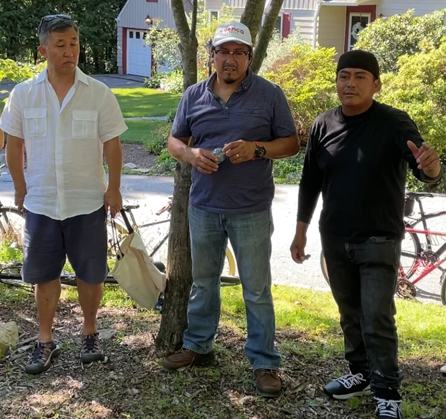
Late afternoon on Saturday, June 25, 2022, residents of Sleepy and Hollow and Tarrytown gathered at the end of Millard Avenue where it meets Broadway. Most of the two dozen or so attendees had biked there after meeting at the Morse School and riding slowly through downtown Sleepy Hollow, escorted by members of the Village’s police department.
Humberto Quinde (right) welcoming attendees, flanked by Sleepy Hollow Trustee René León (center) and Tarrytown Trustee David Kim. Photo by Sayako Aizeki-Nevins.
The purpose of the bike procession and the gathering were to remember the life and death of Luis Ángel Zhizhpon Quinde. Ten years ago, on the night of June 25, 2012, a car struck and killed the 28-year-old Sleep Hollow resident as he rode his bicycle on Broadway (Route 9) while returning from work at a restaurant.
One of Luis Zhizpon’s uncles, Humberto Quinde, opened the brief ceremony by thanking those in attendance for coming and the Sleepy Hollow Police Department for their assistance. He also expressed his gratitude for Bike Tarrytown’s donation of a ghost bike, a roadside memorial placed near the location where Zhizhpon was hit.
José Quinde (left): The ghost bike is “a symbol for life, not just for now.” Photo by Sayako Aizeki-Nevins.
José Quinde, another uncle, called the ghost bike “a symbol for life, not just for now.” Speaking in Spanish, he expressed hope that people maintain the memorial and gather there each year to remember his nephew and the tragedy that befell him.
According to Dan Convissor, the head of Bike Tarrytown, the Sleepy Hollow stretch of Broadway averages twenty-four crashes and seventeen injuries each year. While many residents of Sleepy Hollow and Tarrytown want to ride bicycles in and between the two villages, dangerous roads, he asserted, “make people too scared to bike.”
Ten years ago, in the wake of Zhizhpon’s killing, Sleepy Hollow Mayor Ken Wray called the stretch of Broadway a “death trap,” according to the Tarrytown Sleepy Hollow Daily Voice. “Wray noted several intersections are particularly dangerous, including a five-way intersection of Beekman, Route 9, Route 448, Webber Park and Hudson Terrace,” reported the online publication.
Ten years later, that five-way intersection and Broadway/Route 9 remain as dangerous as ever.
For such reasons, Dan Convissor urged those in attendance on Saturday to support the Route 9 Active Transportation Project. The Village of Sleepy Hollow, he pointed out, has a plan to improve Route 9, but it falls far short of what is need, covering only a two-block area and without addressing the needs of cyclists. “So, I encourage you to push Sleepy Hollow to build a Broadway for everybody,” he said.
The ghost bike, a simultaneously beautiful and poignant tribute to the memory of Luis Ángel Zhizhpon Quinde, sits at the end of Millard Avenue, just across from the site on Broadway where he was struck on June 25, 2012.
It is past time for another memorial: a re-designed Broadway, one safe for pedestrians and cyclists, as well as for drivers.
Many of the attendees at the ceremony, including friends and members of the Quinde family.
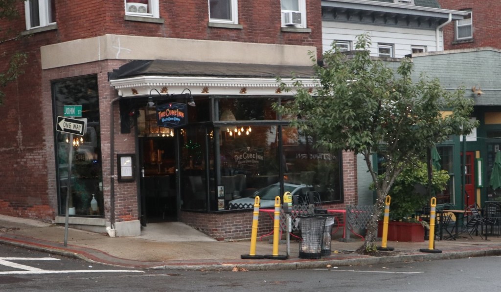
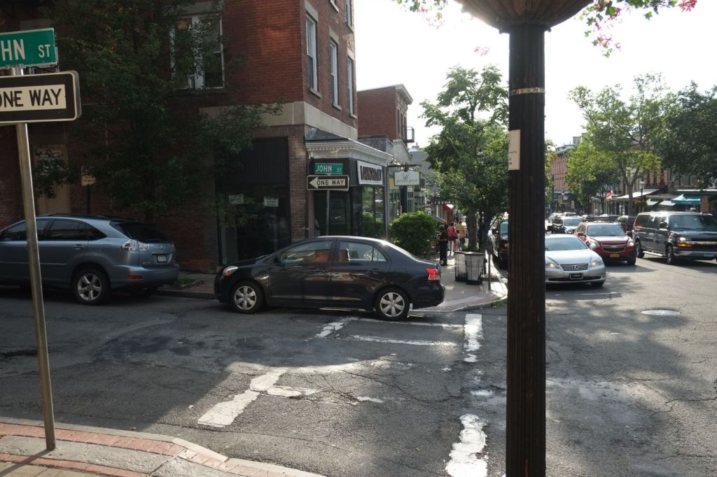
Main Street at John Street, June 16, 2017. When a car is parked on top of a crosswalk, it forces pedestrians into unmarked, less safe areas.
Ensuring safe streets for all is central to the work of Livable Tarrytowns. Of particular concern is the well-being of the most vulnerable: our seniors, children, and individuals with mobility challenges. It was for this reason that our first public presentation—to the Tarrytown Transportation and Mobility Council on January 28, 2021—focused on improving the safety of crosswalks, particularly those on Main Street, not least because drivers often block the crosswalks by parking on them.
Since September 2017 (see “Background” section below), there have been plastic bollards—off and on—at the crosswalk on Main at Kaldenberg Place and John Street, as well as on John Street at Main. The bollards were originally intended as a temporary measure to test their utility. When they’re in place, the bollards generally work. The problem is, they are often not in place as people move them or motor vehicles damage them. At the time of the meeting, no temporary bollards were present on Main Street.
For such reasons, we asked the Transportation and Mobility Council to move beyond this temporary intervention and take permanent measures to provide robust protection and to enhance the visibility of the crosswalks. We provided various suggestions on how to do so (see “What Other Places Do” below).
The Council’s position—and that of Village officials who were present—was that permanent changes (e.g., bollards attached to the ground, sidewalk extensions in the form of bulb-outs) were not necessary. Instead, they advocated more of the same: moveable plastic bollards.
In July 2021, the new plastic bollards finally arrived on Main Street. The results are not encouraging in terms of crosswalk protection and pedestrian safety. Rarely are the bollards where they are supposed to be. As has happened in the past, people are moving them and Village officials do not ensure that the bollards are put back in place. The result is unprotected and less visible crosswalks and persistent pedestrian vulnerability.
Here are photos from two different days that illustrate the problem.
Kaldenberg Place, looking across Main Street. One (misplaced) bollard out of four (the other three are elsewhere). There should be two bollards, one on each side of the crosswalk, at least few feet from each end to prevent drivers from entering or backing into the the crosswalk. August 23, 2021.Main Street at John Street, looking toward Kaldenberg Place. Note lack of bollards on both ends of the crosswalk. September 28, 2021.In case you’re looking for the bollards, here they are! September 28, 2021.
These images (ones that are hardly unique to the two days illustrated above) show—once again— that moveable bollards are inadequate (in addition to a waste of money).
Beyond the Main Street crosswalks, there is a need for a broad program of pedestrian safety and infrastructure. In many places in the Village, crosswalks are unsafe. Bike Tarrytown and the Tarrytown Environmental Advisory Council (TEAC) have made this known in recent years, but the Village has done little in response.
Enhanced crosswalks are beneficial for reasons of pedestrian safety, but they also make walking more attractive. This is is good for air pollution, climate change, and our local businesses—as people who walk a lot are more likely to conduct their business nearby.
As suggested by the images in the next section, there are viable alternatives to the unsafe-crosswalk status quo. Livable Tarrytowns will work with our neighbors and officials in both Tarrytown and Sleepy Hollow to identify these alternatives and bring about the necessary changes.
What Other Places Do
This simple, low-cost measure is on Pocantico Street in Sleepy Hollow, across from the Morse School. The photo is the courtesy of Bike Tarrytown.Downtown Ossining. The bollards coupled with painted crosswalk and white striping greatly increase the crosswalk’s visibility, communicating to drivers the need to proceed with care.Baltimore, Maryland. Creatively painted crosswalks provide additional benefits, one being an opportunity for area residents to share their creativity and artistic skills.Baltimore, Maryland.New York City. The “bulb-out” helps to slow down vehicles as they go around the corner.
Background
Several years ago, the Tarrytown Environmental Advisory Council worked on a “Complete Streets” initiative. This included a walking audit of streets in and the downtown area with a goal of making them safe, attractive, and environmentally sound. Out of this initiative grew an effort to improve the crosswalks on Main Street—especially because drivers often blocked them.
As an interim measure, TEAC members proposed to the Village that temporary bollards be installed to protect the crosswalks with an eye toward some sort of permanent change. The response of the Village was more or less twofold: we don’t have the money for bollards and we’re not convinced that pedestrian safety is a issue at the crosswalks. So, with a small grant related to Complete Streets, TEAC purchased the bollards and a couple of TEAC members gathered data; this involved three one-hour “studies” of Main Street crosswalks on three different days to demonstrate the need for the installation of bollards to the Village. When TEAC presented the results to Village officials, they agreed to the installation of temporary bollards.
Below is a small sample of the photos taken from two of the “study” days.
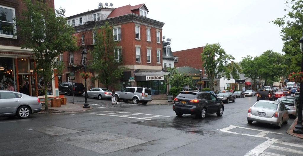
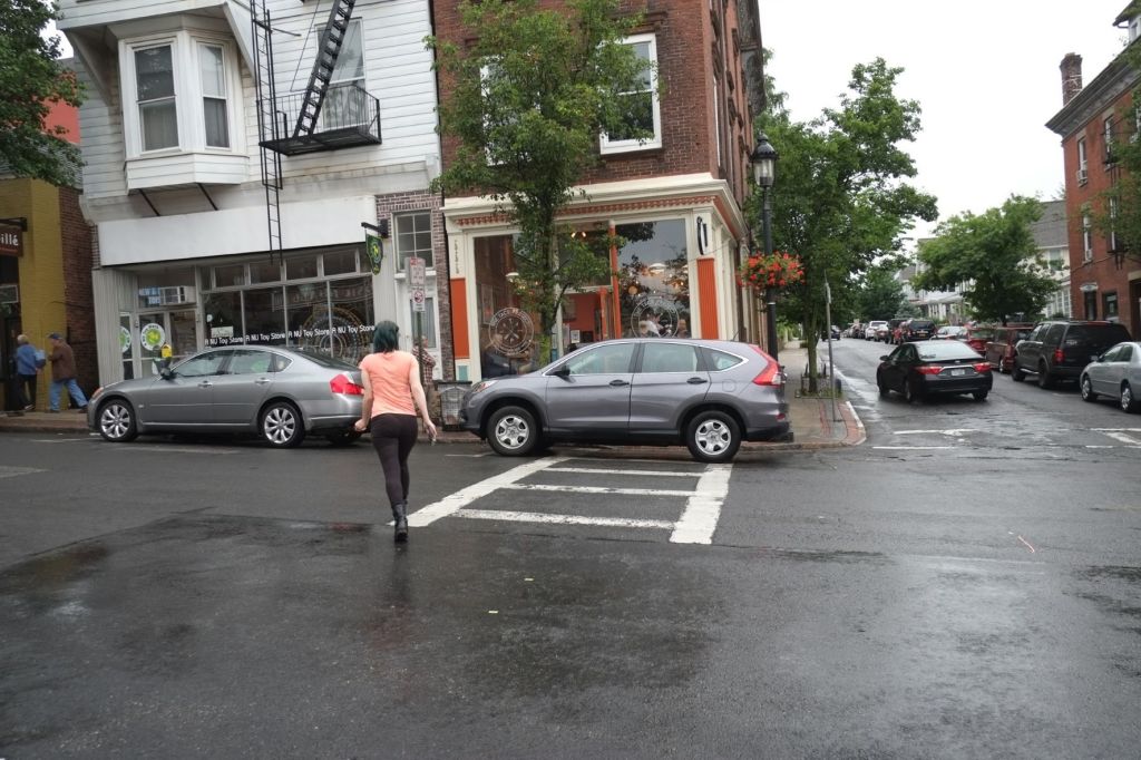
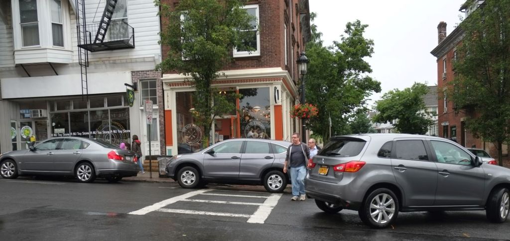
June 16, 2017, 6:22pm. Note car parked in crosswalk at then-laundromat.June 16, 2017, 6:53pm.June 16, 2017, 6:55pm.June 16, 2017, 6:57pm.June 23, 2017, 6:54pm, Main at Broadway. The Village has never placed even the temporary plastic bollards at this crosswalk despite the well documented need.June 23, 2017, 6:19pm.June 23, 2017, 7:03pm. To be safe, because they are worried that a car may back into them, pedestrians are compelled to maintain a good distance from a car parked in a crosswalk