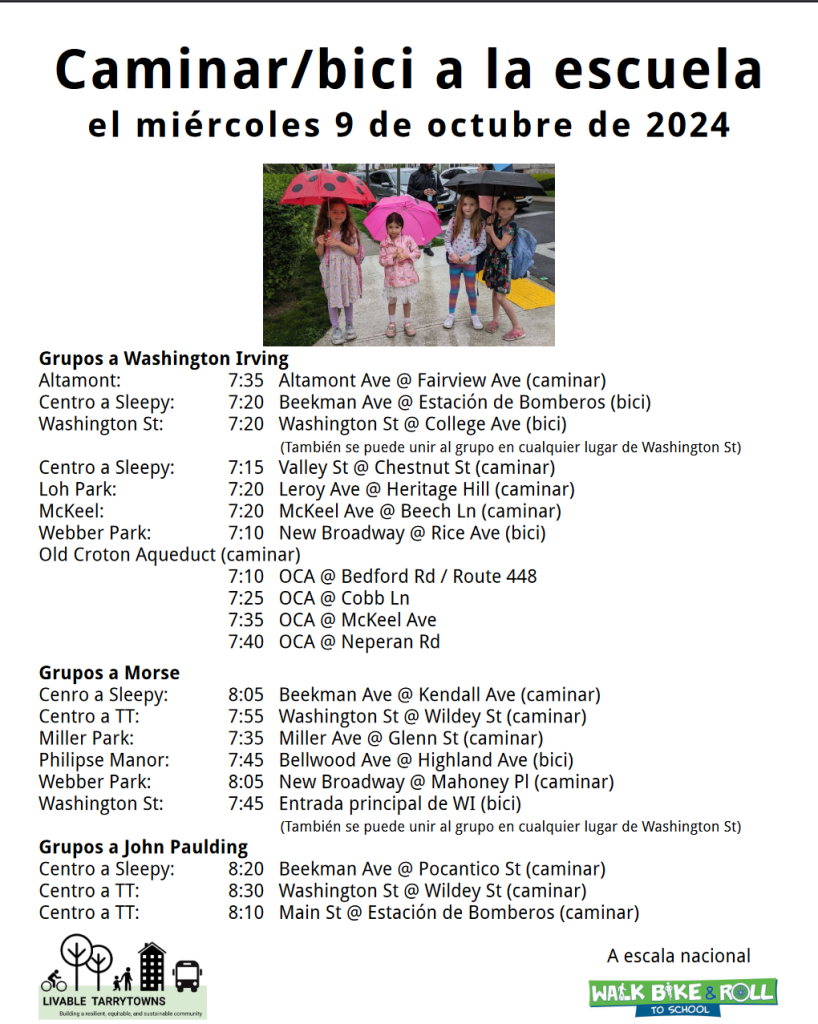
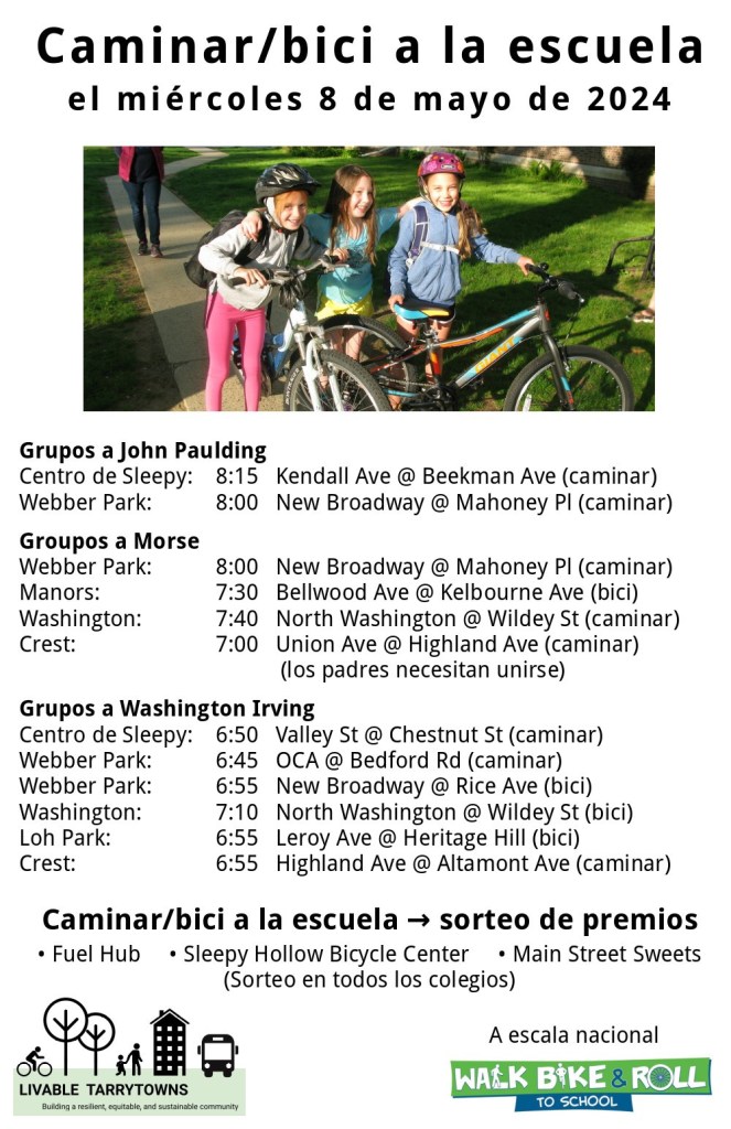
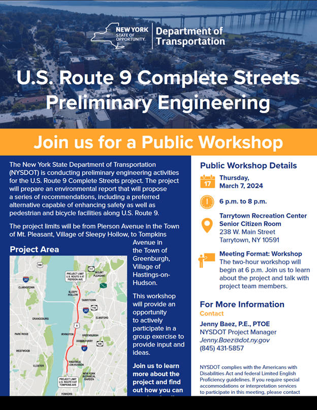
On the morning of Saturday, October 5, 2024, Tarrytown Mayor Karen Brown joined Lesley Walter, President of Friends of The Old Croton Aqueduct, Robert Lee, Assistant Manager of Old Croton Aqueduct State Historic Park, and members of Livable Tarrytowns’ Old Croton Aqueduct (OCA) working group, for a walk along the OCA trail. The trail is important for many reasons. Chief among them is that it is a well-used route for students and their families walking to and from the Washington Irving School and the John Paulding, middle school, and high school campus.
Beginning at East Franklin and Broadway in Tarrytown, the group headed northward to Bedford Road in Sleepy Hollow. Along the way, the group stopped at each street crossing to evaluate it and consider measures to improve pedestrian and bicycle safety. Below we outline Livable Tarrytowns’ suggestions for improvements.
The first stop was Elizabeth Street. The intersection needs three improvements:
- ADA conforming curb cuts on both sides of Elizabeth Street;
- a painted and raised crosswalk; and
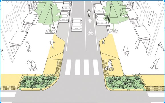
- a “daylighting” of the northside of the crossing area, with a 15-foot clearance on either side.

The group then proceeded to Neperan Road, a two-way street that sees a good deal of traffic. Of particular concern is the high speed at which many vehicles come down the hill as they head toward Broadway. This is concerning not only for people traveling along the OCA trail, but also individuals coming to and from nearby Neperan Park, many of whom cross Neperan Road. As such, a broader set of interventions are needed. They include:
- a 3-way stop sign at Altamont and Neperan to force vehicles to slow down at what is a blind curve;
- a painted crosswalk that connects the curb cut at Altamont and Neperan to the entrance at Neperan Park;
- the installation of an ADA curb ramp at the access point of Neperan Park;
- a painted crosswalk with signage on Neperhan at Grove Street;
- a painted crosswalk with signage at the OCA crossing and a curb extension or bump out on the north side; and
- the removal of the two parking spots immediately adjacent to the OCA trail entrance on the north side of Neperan.
Hamilton Place was the next stop. Participants in the group identified three measures that are needed:
- a painted crosswalk, along with signage, connecting the two sides of the OCA trail at Hamilton;
- an ADA-conforming curb cut on the southside of Hamilton; and
- the prohibition of parking on the southside of Hamilton within 15 feet of the OCA trail (see the red vehicle in the photo below).

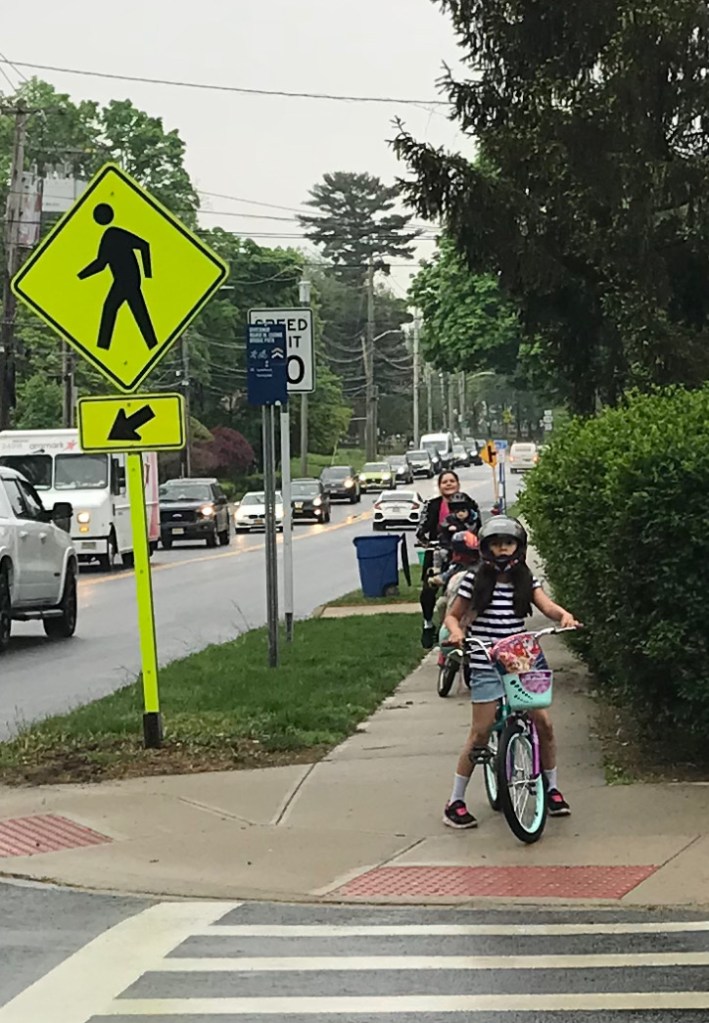
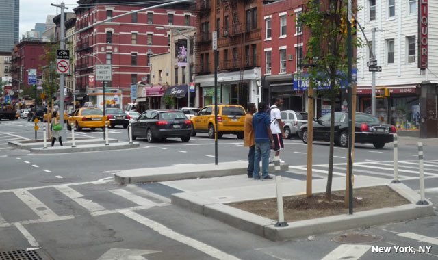
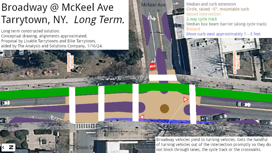
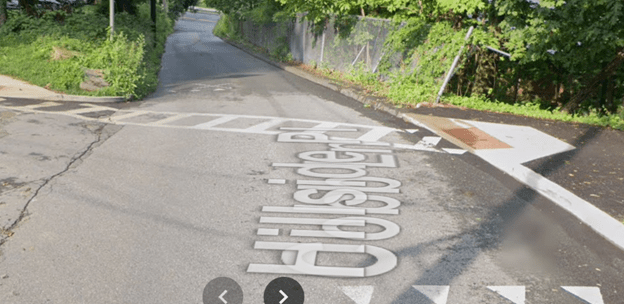
After Hamilton Place, the group continued northward to McKeel Avenue, a street of major concern for area residents. It was near the OCA crossing where a vehicle struck and killed Mr. Anthony Napoli on August 4, 2022. A crosswalk, signage, and ADA curb cuts are already in place on McKeel (see photo below). Nonetheless, further improvements are needed–not least because of the width of the road and the fact that pedestrians must cross two lanes of traffic. Given these factors, curb extensions or bump outs are needed on either side of the crosswalk. Also necessary are measures to slow down vehicular traffic, particularly at times when the sun makes it difficult for drivers to see the road. Possible measures include: a narrowing of the road, chicanes, and/or speed bumps.

Cobb Lane, a very steep and narrow street, was the next stop. Despite many pedestrians using the street to access the OCA, the various schools on the TUFSD campus, Patriots Park, and other points on Broadway, there is no sidewalk or barrier to protect them. Here are two changes that could improve matters:
- the painting of a 5-foot wide “sidewalk” (with some sort of raised edge) along the north side of Cobb Lane from the OCA to Broadway; and
- making Cobb Lane from the OCA to Broadway a one-way street.
Finally, the group went through the campus of Sleepy Hollow Middle School and Sleepy Hollow High School. Because part of the school building sits atop the actual aqueduct, the trail goes around the east side of the building. Then, north of the building, because several property owners on Hudson Terrace have blocked the OCA’s right of way up to Bedford Road (Route 448), trail users must travel through a parking lot. Resolving these difficulties requires short term and long term steps.
Short term:
- Wayfinding signs at appropriate locations on the school campus;
- a dedicated walkway on the east side of high school parking lot adjacent to the baseball and softball fields;
- unlocking the gate at Bedford Road on the east side of parking lot to allow walkers and bikers to access the trail system connecting the OCA and Tarrytown Lakes;
- an adjustment of the driveway gate so there is a five-foot-wide passage for bikes, adaptive bikes, and wheelchairs; and

5. the relocation of the map sign from the school side of Bedford Road (see photo below) to the trail side.
Long term:
- A raised crosswalk on Bedford Road, with signage, at the north end of the high school parking lot; and
- reclamation of the OCA property behind Hudson Terrace.
Livable Tarrytowns will push for these changes and more by working with officials in both Sleepy Hollow and Tarrytown as well as with the Public Schools of the Tarrytowns. If you have suggestions for additional improvements, please reach out!